Ha Giang is a province in Northeast Vietnam. The province shares border with Cao Bang in the east Yen Bai and Lao Cai in the west and Tuyen Quang in the south.
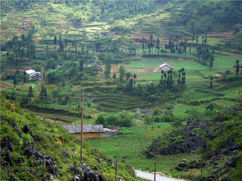
The natural area of the province is 791,488.92 square kilometers. In which agricultural and forestry land account for 678,597.13 Ha, the non-agricultural land accounts for 2,6476.85ha, and the unused land is 86,414.94ha. Located in the north pole of Vietnam, Ha Giang has lots of stone mountains and rivers. With the strongly fragmented terrain, Ha Giang topography is divided into 3 sub regions with different features.
The northern rocky upland consists of districts of Meo Vac, Dong Van, Yen Minh, Quan Ba with the average altitude from 1000m to 1600m; high limestone mountains adjacent the northern tropics. This land is characterized by the temperature climate, suitable for the development of fruit trees as plum, peach, pear, apple... and precious medicinal plants such as cardamom, Eucommia ulmoides, Scrophulariaceae, Job's-tears...The whole area was recognized the global geopark by UNESCO with the total area of 2,368.6 square kilometers.
The western upland consists of Xi Man, Hoang Su Phi districts and some communes of Bac Quang, Quang Binh and Vi Xuyen district. The average altitude is from 900m - 1000m, with steep slopes, high passes, valleys and narrow rivers. The weather is divided into 2 seasons: The rainy season starts from April to October, the dry season is from November to March of next year. The weather condition is suitable for plating sub-temperature plants, forestry, raising honey and planting some long-term industrial crops as tea, pine, especially Shan Tuyet tea.
The low hill is the valleys along Lo River. This is the key economic zone of the province including Ha Giang city, and districts of Bac Me, Vi Xuyen, Bac Quang and Quang Binh. The average height of the region is from 150m to 350m. The temperature is from 21 degree Celsius to 23 degree Celsius, the rainfall is from 1808 - 3181mm, favorable for wet rice cultivation, forestry and tropical plants as citrus fruits, industrial crops (tea, mulberry, trau), livestock, poultry and aquaculture. This area has the potential for development of the agro-forestry-fishery, especially the strengths in industry, service and trade.
Ha Giang today has gone through many changes in the border and the name. During the Hung King period, this land was the inhabited area of people in Tay Vu, until the 11th century, it named Chau Binh Nguyen. Under the Ly Dynasty, it belonged to Phu Luong district and under the Tran Dynasty, it was Truong Phu Linh. During the reign of Le Dynasty, it was renamed Chau Vi Xuyen. In 1835, Chau Vi Xuyen was separated into 2 districts of Vinh Tuy and Vi Xuyen. In 1842, Tuyen Quang province was established. In 1976, Ha Giang and Tuyen Quang were merged into Ha Tuyen province. In 1991, Ha Giang province was separated from Ha Tuyen with administrative units including 9 districts and 1 town.
According to the population cencus in 2011, the population of Tuyen Quang is 749.537 people, the average population density is 95 people/ km2. Ha Giang is a mountainous province, so the province's population is sparse. Kinh ethnic people covers the majority of Ha Giang population, the rest is other ethnic groups including Tho, Meo, Tay, Dao, Man, Nung, Giay and Lo Lo.
Ha Giang province includes 1 city, 10 districts: Bac Me, Bac Quang, Dong Van, Hoang Su Phi, Meo Vac, Quan Ba, Quang Binh, Vi Xuyen, Xi Man and Yen Minh, and 196 communal administrative units. Ha Giang city is the center of economy, politics and culture of the province.
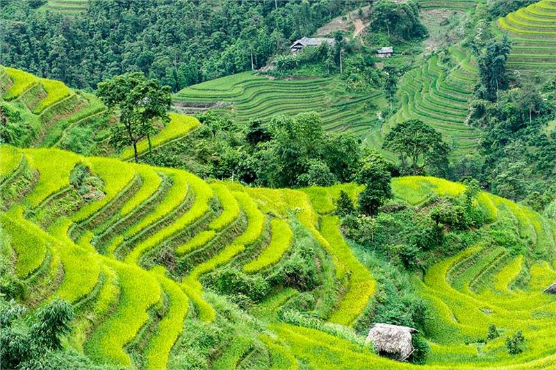
Due to the mountainous terrain, Ha Giang economy is relatively underdeveloped. The province has several precious woods as "lat hoa", "lat da dong", iron wood, "sen" (Madhuca pasquieri ), "trai" (Tembusu), "tau" (Vatica) and "dinh". "Cu nau" (Dioscoreaceae), bamboo trees appear everywhere in Ha Giang. Agricultural products consist of rice, corn, sweet potatoes and types of bean. Under the foot of Tay Con Linh Mountain, local people plant tea. Ha Giang people also plant fruit trees as plump and pear in Dong Van region and Hoang Su Phi. Ha Giang forest has many wild animals as phoenixes, pythons, snakes, peacocks, etc.
The economy in lowland as Vi Xuyen, Bac Quang is more developed than the mountainous region. Relying on Lo River and the large rainfall, the agriculture sector in this area is very developed, not less the midland. This area is famous for orange and fertile paddy fields. Scattered from Vinh Tuy to Vi Xuyen, there are factories processing tea, especially Shan Tuyet tea - the specialty of Ha Giang. Shan Tuyet tea's characteristics are clean, no pesticides and stimulants, the tea factories are now also encouraging local people to plant ginger trees among beds of tea. Shan Tuyet tea of Ha Giang has been exported to international markets as Taiwan, Japan and some Western countries.
The gross regional domestic product (GRDP at constant price 2010) was estimated at 9,257.2 billion dong, an increase of 6.32% compared to 2013. The economic structure shift positively: agriculture, forestry and fishery accounted for 37.43% (falling 0.35% compared to 2013); industry and construction accounted for 26.17% (an increase of 0.22% over 2013), service accounted for 36.4% (increasing 0.13%). The GRDP per capita reached 16,2 million dong/person/year (up 11.3%). Total investment capital in the province was estimated at 5,245.5 billion dong, up 5.9% compared to 2013.
Despite being a mountainous region with many difficulties, in recent years, the province has focused on modeling and teaching the culture of ethnic communities into school, improving the life skills for students. The quality of education continues to make positive changes; comprehensive education quality is gradually raised. The national health program has been implemented as planned, preventative health activities are maintained regularly and effectively; diseases is inspected, monitor closely.
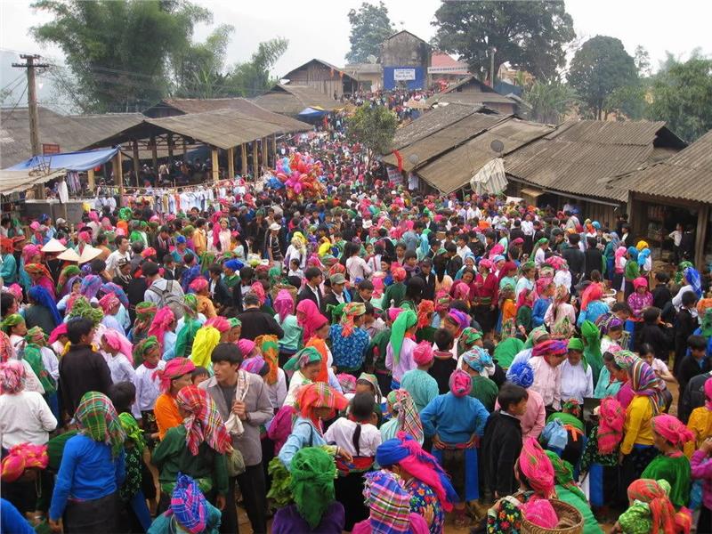
Ha Giang is the ancient land, has a long history, on the basic features corresponding to the main stages of Vietnamese history. Ha Giang is an integration of civilizations in the Metallic Age, creating a brilliant civilization in Ha Giang. In particular, archeologists found many bronzes and archaeological artifacts typical for construction period of the country in this province. These are solid background to form the unity in the diversity of Dong Son civilization. Coming to Ha Giang, you have the opportunity to participate in traditional festivals as "Nhay Lua" of Pa Then ethnic people (from the 15th day of the 10th lunar month to the 30th day of the New Year), Khau Vai Love Market only opens once a year in March 27th of lunar calendar.
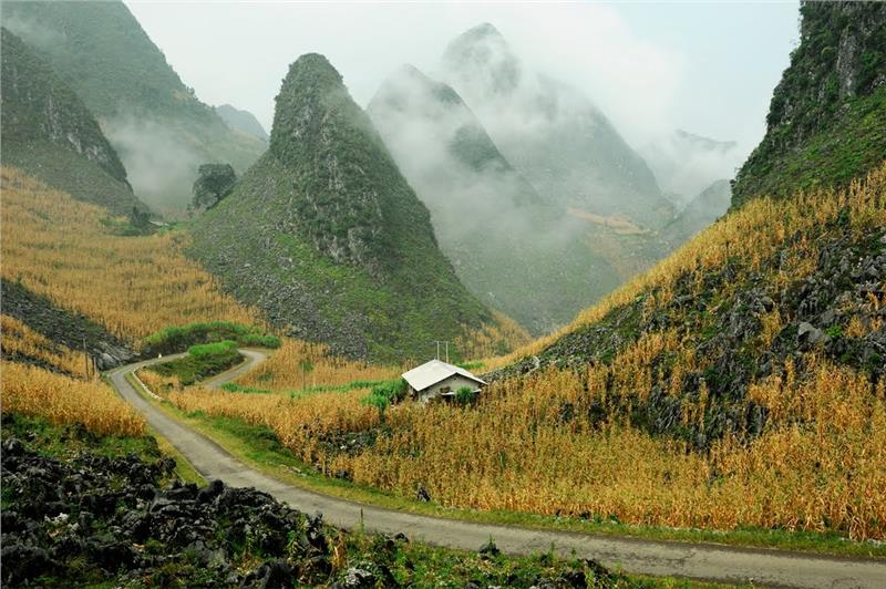
Dong Van Stone Plateau recognized the Global Geopark in 2010 is stretched in 4 districts of Quan Ba, Yen Minh, Dong Van and Meo Vac. This is one of the special karst plateaus, containing the typical imprints of the development of earth's crust, the natural phenomenons, unique landscapes, biodiversity and the long-standing cultural tradition of the local people as Mong, Lo Lo, Pu Peo and Dao. The stone plateau is the home to many national relics and landscapes as Vuong family mansion, Lung Cu flag tower, Dong Van ancient town, Ma Pi Leng Pass, Doi Quan Ba Mountain, so on. Dong Van is famous for fruits as plump, peach, apple, pear... and medicinal plants: "tam that" (type of bulbous aralia), "thuc dia", anise, cinnamon.
Phuong Thien Cave is located about 7km from Ha Giang city. This place has the beautiful landscapes and natural caves. Tien Cave (Fairy Cave) and Fairy Spring are located about 2km away from Ha Giang city. Local people often take the water at the cave and pray for the luck at Eve. Chui Cave is located about 7km from Ha Giang city. The cave has deeply ingrained into the mountains over 100m (300ft). The entrance is narrow, so visitors have to worm into the cave. Inside the cave is wide; the cave's vault is high and has many stalactites. The cave is the home to bats and has a stream flowing down like a waterfall.
Located in Sa Phin commune, Vuong family mansion is a beautiful and unique architectural work ranked the national level in 1993. The building is surrounded by a stone wall. The mansion was built mainly with blue stones, po-mu wood, and terracotta tiles. Details were sculpted meticulously and sophisticatedly with dominant image of dragon, phoenix, bats… symbolizing wealth and prosperity. The mansion brings the superficial and majestic beauty with the architecture of "Wang" script, located in the tortoise shell-shaped hill. This is an example of the interference of the art architecture and Mong people and Chinese people in the border area between Vietnam - China.
Khau Vai Love Market meets only once a year in the 27th of the 3rd lunar month in Khau Vai commune, Meo Vac district. Originating from a love story, Khau Vai has become a dating spot for all couples in the region. In the last 10 years, economic pressures have led to a market being set up to capitalize on the anniversary celebrations. Therefore, coming to Khau Vai market, people can purchase and exchange the specialties of the mountainous region.
Sung Khanh Pagoda is situated about 9km from Ha Giang city to the south in Nung village, Dao Duc commune, Vi Xuyen district, ranked as the historical relic in 1993. The pagoda stores 2 relics: the stone stele under Tran Dynasty (1367) recorded the merits of the founder of the pagoda and a 0.90-meter-high bell casted in Hau Le Dynasty (1705). Carving art in stone, on a bronze bell and casting technique are evidences for sophisticated hands of the artisans in the northern border.
Festival
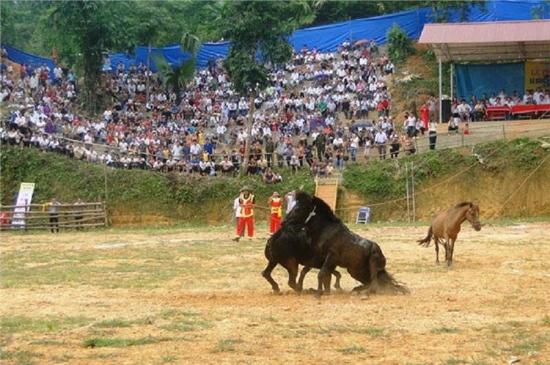
Ha Giang is home to many unique cultural products from a long tradition of more than 20 ethnic minorities, a memorable tourist destination by the natural landscape and its people. Unlike other tourist destinations in Vietnam, coming to Ha Giang visitors can admire the products crystallized from the unique cultural traditions of people in the mountainous region which is embroidered scarfs, bags, dresses with brightly patterns.
Due to the presence of more than 20 ethnic groups, cultural festivals in Ha Giang are diverse and unique. Many of these groups are noted for their artistic abilities, especially their weaving and hand-made textile products. The festival to celebrate the new house of Lo Lo people is held about 2 days and 2 nights. All villagers participate to celebrate for the new house. The Spring Festival is celebrated by the H'Mông and Dao ethnic people, usually shortly after the Lunar New Year and lasts between three and seven days. The people celebrate with singing and feasting and drinking alcohol. The festival is held to celebrate the victory, pray for good weather and pray for a son.
